Made in Australia, by Australian hunters, for Australian hunters.
The Hunting App
This app has been proudly produced in Australia to help you comply with DPIRD Hunting Written Permission Conditions when hunting on NSW Public Land with an R-Licence.
Map, mark and track the Australian terrain, offline.
DPIRD Compliant Maps
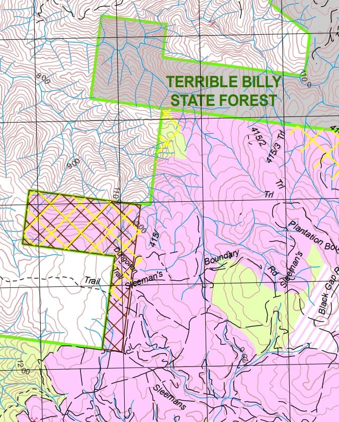
Hunt the right ground. Load as many NSW DPIRD state forest maps as you need, free forever.

Mark Waypoints
Camps, stands, glassing points, kill sites. Drop pins and never lose a spot.

Topo Map Overlay
Import GeoPDF and State Forest maps. Pinch, zoom, plan over real terrain.

Track Your Hunt
GPS breadcrumb trails, route distances, and movement logs through the day.
A serious mapping tool
built for the Aussie bush.
Drop waypoints, lay tracks, layer the maps that actually matter in Australia. NSW DPIRD hunting maps and state forest boundaries today, with premium Athena based layers and paid custom map downloads on the way.
Australian map sources
NSW DPIRD hunting maps, state forest boundaries and Aussie topographic layers in one place. Switch sources without losing your pins or routes.
Smart waypoints
Camp, vehicle, glassing, water, shot taken, rubs, wallows, plus species tags for the game we actually hunt here. Deer, pig, goat, fox, rabbit and more.
Tracks and routes
Live GPS breadcrumb trails. Import tracks from Google Earth. Mark walking lines, vehicle access and creek crossings.
Aussie licences and rules
Store your R-Licence and other state hunting licences in app. Pull up safety rules and area guidelines for Australian state forests without scratching for signal.
Field Lock Mode
Pocket safe, glove friendly, rain proof. The app keeps running for the whole day without phantom touches.
Import from anywhere
Bring your data across in minutes. GPX, KML, KMZ and GeoPDF from Google Earth, OnX, Gaia and more. No re-mapping from scratch.
What it actually looks like
on the phone.
Glove friendly controls. Dark by default for the pre-dawn walk in. Built around the way Aussie hunters actually move through a day.
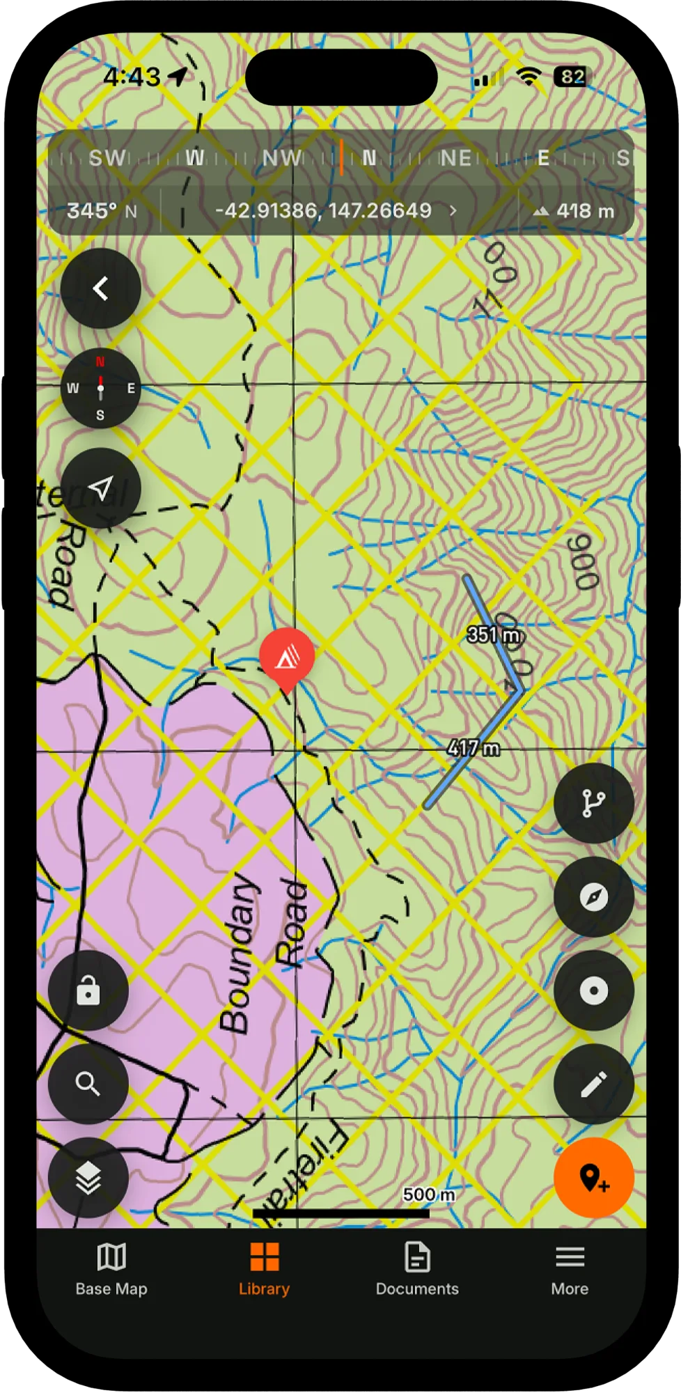
Map view
Layered for the bush
DPIRD maps, topo lines and live GPS in a single canvas.
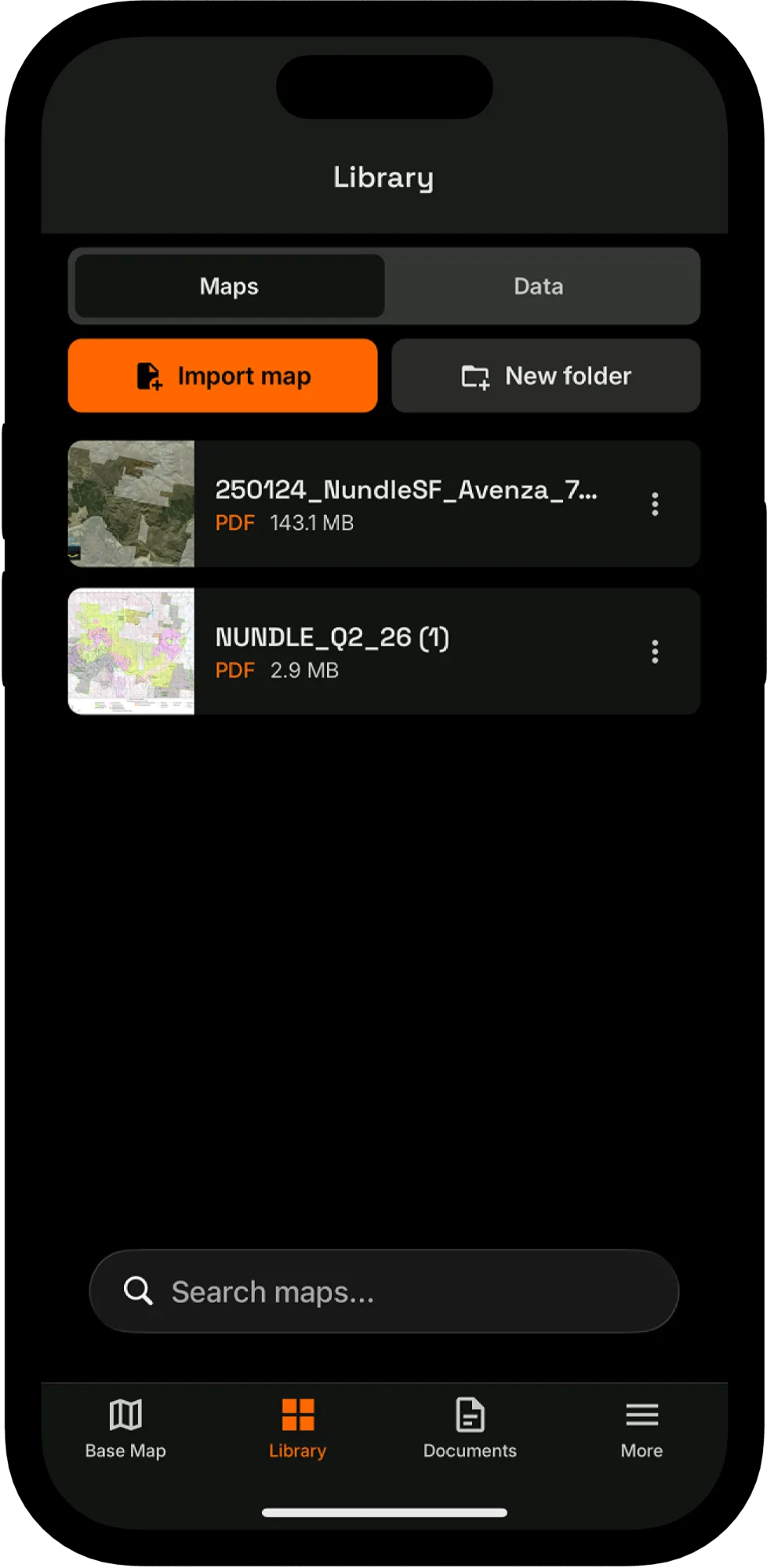
Map library
Your maps, organised
Swap providers, manage offline regions, jump between saved areas.

Marker icons
A pin for every story
Camps, glassing points, water, sign, kills. Tagged and tappable.
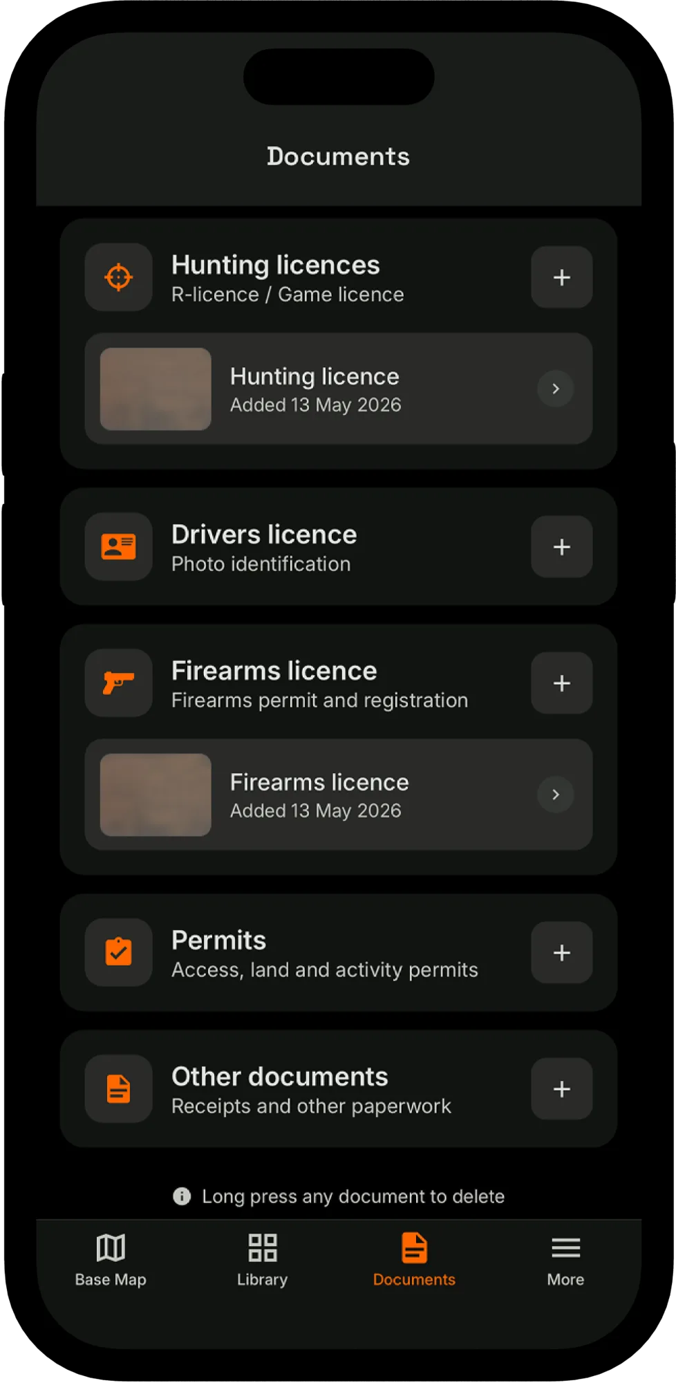
Documents
Paperwork in your pocket
R-Licence, state permits and safety rules. Ready offline.
Like what you see? Get the app.
Built by Australians who actually
hunt the country.
We got tired of stitching together six overseas apps, a paper map and a screenshot of a state forest closure notice. The Hunting App pulls the mapping side into one tool, designed in Australia for the way we hunt here. Holds up when service drops and the rain starts.
Works where signal doesn't
Your maps, waypoints and tracks live on your phone. Lose service in the gully, the bush, or the back of the forest. The app keeps working.
Three clicks. Done.
Drop a waypoint, log a track, pull up a map. Every common action is built to be done with one hand, in cold weather, without taking your eyes off the country.
The Australian maps that matter
NSW DPIRD hunting maps, state forest boundaries and Aussie topographic layers in one place. Stack what you use, switch sources without losing your pins or routes. Premium Athena based layers and custom paid map downloads coming soon.
Built for the Australian bush
Glove friendly, rain proof, pocket safe. Keep your state hunting licences on hand and the rules at your fingertips. Designed for the country we hunt, by people who hunt it.
We're just getting started.
The Hunting App is in active development. Here's what's already in the field, what we're testing right now, and what's on the bench. Get on board early and help shape it.
Web route planner
Plan trips on the big screen at home. Drop waypoints, import GeoPDF maps, draw routes. Syncs to mobile.
Mobile app
Offline maps, GPS tracking, waypoints and Field Lock Mode on iOS and Android. Built for full-day field use.
Lock screen widget
See tracking status, hunt area and GPS state without unlocking the phone. Quick re-entry to the map.
In-app Camp Planning
Coordinate with your hunting party. Share live waypoints, camp locations and movements without leaving the app.
Premium Athena map layers
Athena based map layers built into the app, plus paid custom map downloads for the area you actually hunt. No more juggling separate apps for your DPIRD maps.
Wind and weather overlays
Forecast wind direction, temperature and visibility on the same map you're planning your stalk on.
Season-on-season analytics
Heatmaps of where you have hunted, taken shots and seen sign. Your personal hunting record, year after year.
Your next hunt starts with a plan.
Map, mark and track the Australian terrain, offline. Available now on iOS and Android. Made in Australia, built for the bush.